Process Drone Images into Maps, Models, and Insights
Upload your aerial images. We process them into survey-ready outputs using advanced photogrammetry pipelines
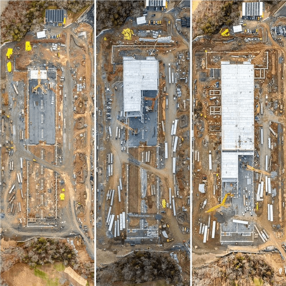
Accurate & Precise Land Surveying Services
Drone Image Processing
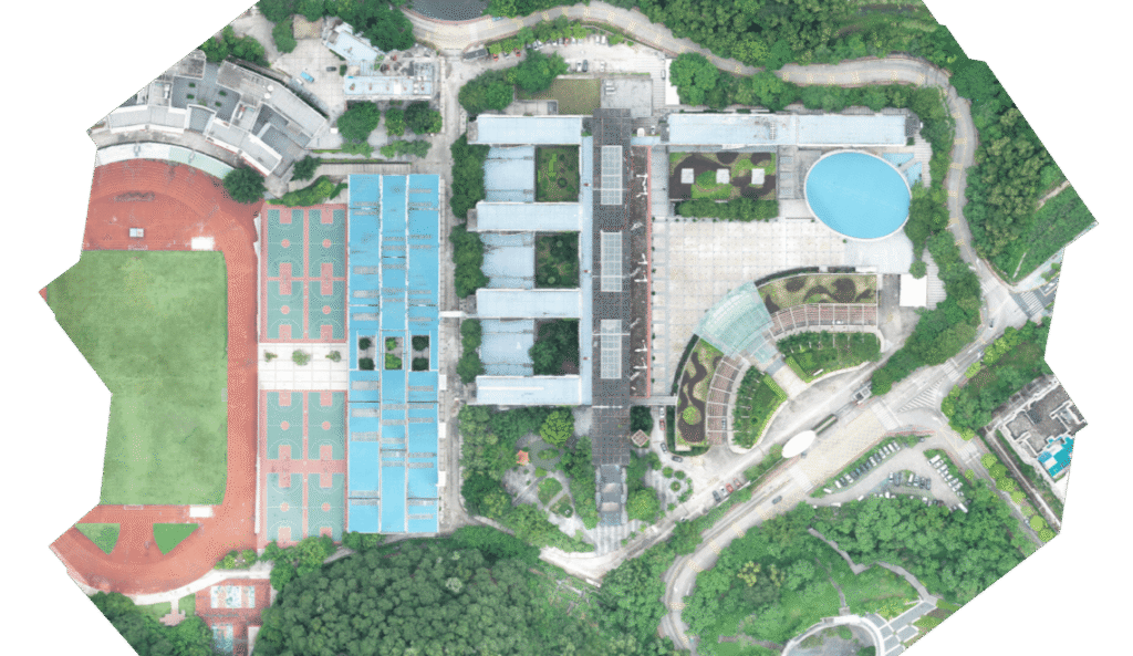
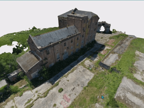
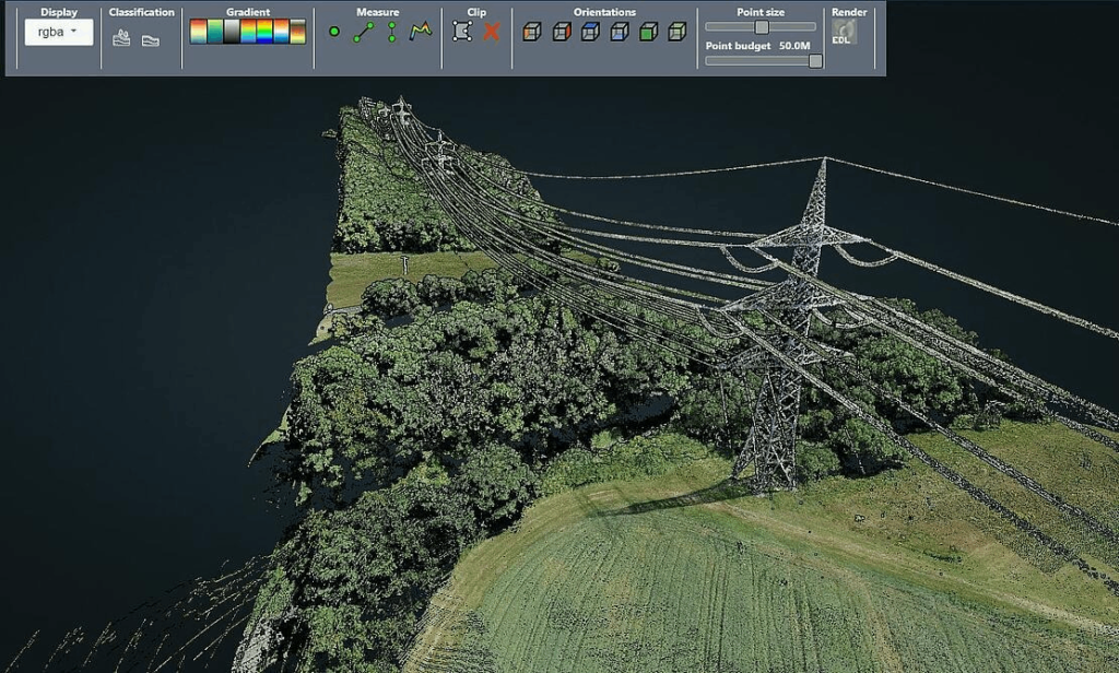
We process raw drone imagery into accurate and georeferenced mapping products.
Deliverables
Orthomosaic (GeoTIFF)
3D textured mesh
Dense point cloud (LAS/LAZ)
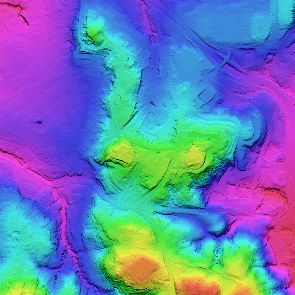
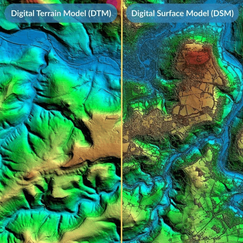
Digital Surface Model (DSM)
Digital Terrain Model (DTM)
Ideal For:
Land development
Construction planning
Site inspection
Infrastructure mapping
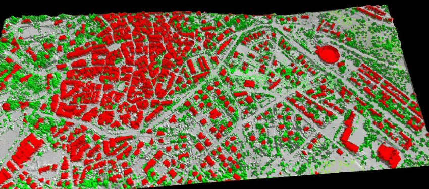
DSM & DTM Generation
We generate high-resolution elevation models for engineering and analysis.
DSM (Digital Surface Model)
Includes buildings, trees, and structures.
DTM (Digital Terrain Model)
Vegetation and objects removed for bare-earth modeling.
Applications:
Drainage design
Flood risk modeling
Road planning
Earthwork calculations
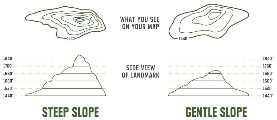
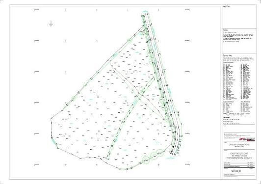
Topographic Mapping & Topo Points
We extract accurate topographic points, breaklines, and contours for CAD integration.
Deliverables
Contours (DWG / DXF, GIS)
Spot elevations
Breaklines
Digital Surface Model (DSM)
Topographic GIS drawings
Perfect for:
Civil engineers
Surveyors
Road designers
Infrastructure projects
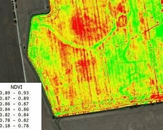
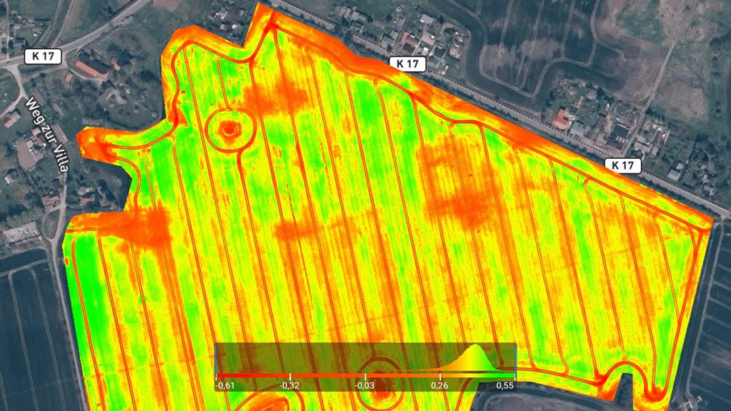
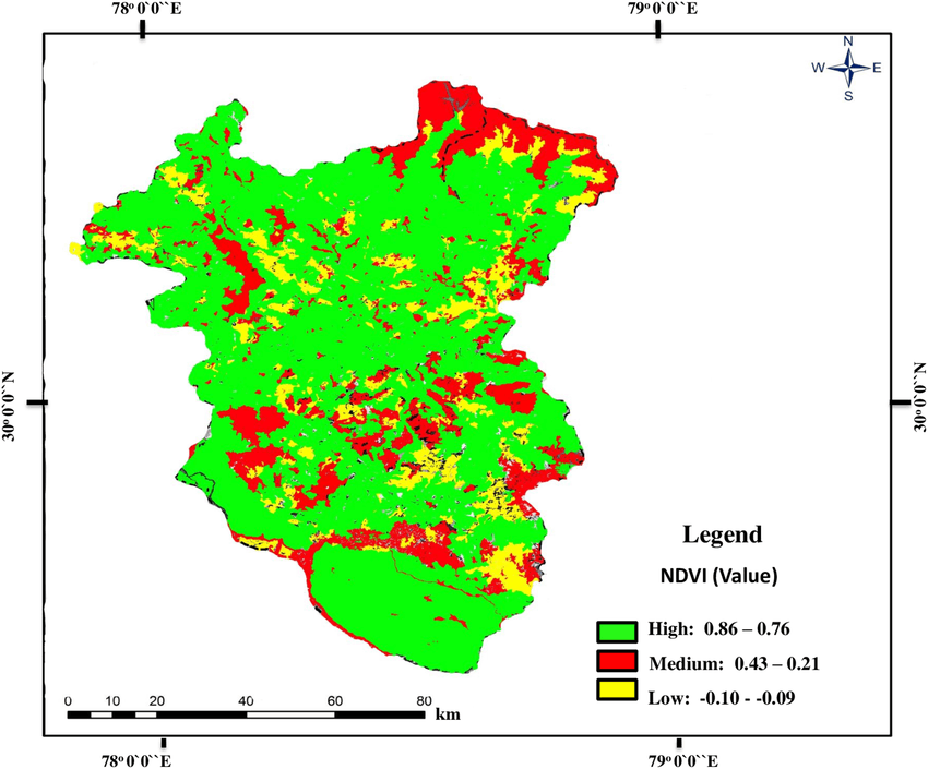
NDVI & Vegetation Analysis
We provide crop health and vegetation analysis using multispectral imagery.
Services:
NDVI maps
Vegetation index reports
Crop stress detection
Zoning maps
Used by:
Farmers
Agronomists
Plantation managers
Environmental consultants
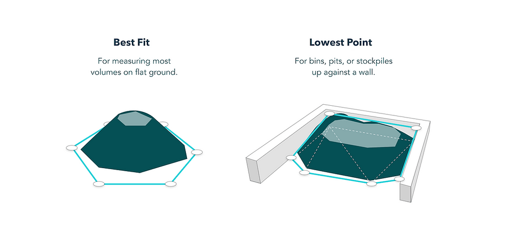
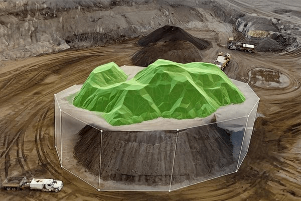
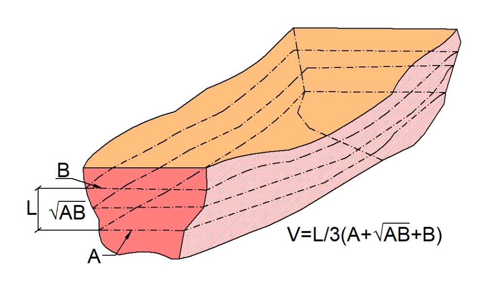
Stockpile Measurement
Fast and accurate volume calculations for material management.
We Provide:
Volume reports
3D models
Monthly progress tracking
Comparative analysis
Industries:
Mining
Quarry
Construction materials
Waste management
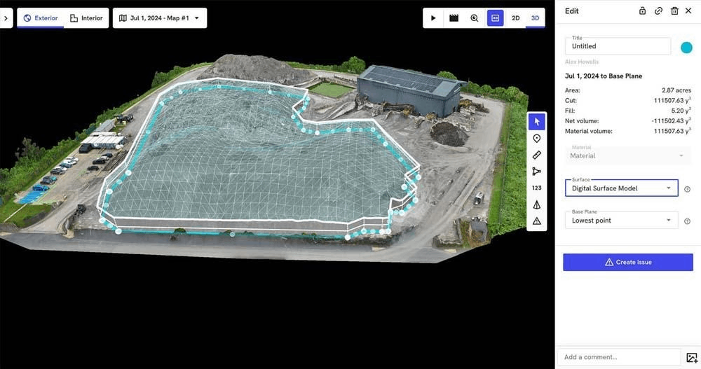
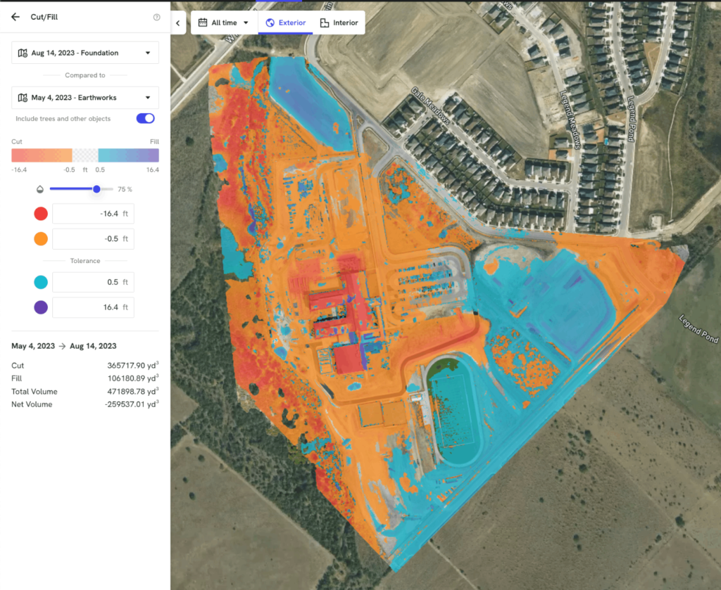
Cut & Fill Analysis
We calculate earthwork volumes to support construction and grading projects.
Deliverables:
Cut/Fill heatmaps
Volume summary reports
Before & after surface comparison
GIS compatible files
Ideal for:
Road construction
Site preparation
Land grading
Infrastructure projects
How it works
Our streamlined workflow ensures fast, accurate results—from submitting your project details to receiving high-quality, ready-to-use survey data, all within a reliable turnaround time.
01
Send Your Project Details
Upload your drone imagery and provide project information.
02
Processing & Quality Control
We process your data using professional photogrammetry software and conduct detailed QA checks.
03
Delivery
You receive ready-to-use files in your required formats (GeoTIFF, LAS, DWG, DXF, Shapefile etc.) Turnaround: 2–5 business days depending on project size.
Data Processing Services
BASIC (Photogrammetry Only)
Price
$50 – $150 per project
or $0.10 – $0.20 per image
Includes:
Orthomosaic (2D map)
Basic 3D model
Standard resolution output
No editing / minimal QA
Positioning:
Upload your drone images → get processed map fast
photogrammetry-only service (no GIS, no advanced work).